Whether you believe in climate change or not, one thing’s for sure — our planet has definitely changed over the last few decades, and there’s plenty of evidence to prove it.
According to NASA, the global temperature has risen by 1.7 degrees Fahrenheit since 1880, and nine of the 10 warmest years on record have taken place since 2000. Sea ice and land ice are both losing mass and carbon dioxide levels in the air are the highest they’ve been in 650,000 years.It’s easy to brush off the facts without seeing the changes for ourselves, but these images from NASA capture just how much our planet is being affected by rising temperatures and other changes in our climate.
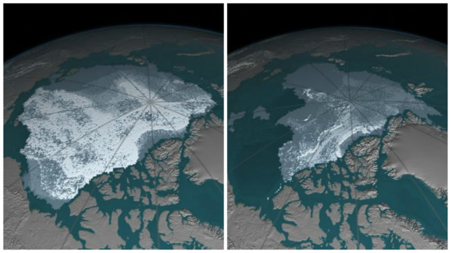
1. Between September 1984 and September 2016, the area covered by Arctic sea ice has dramatically decreased from 718,000 square miles to just 42,000 square miles.As you can see below, much of the older ice (shaded white), which is less vulnerable to melting, has disappeared.
2. Glaciers along the Bellingshausen Sea coast of western Antarctica have been shrinking for at least four decades, likely because of warm ocean water affecting the grounding lines–the point at which glaciers start to float.Mass loss from Antarctica has been strongly linked to changes in these lines.

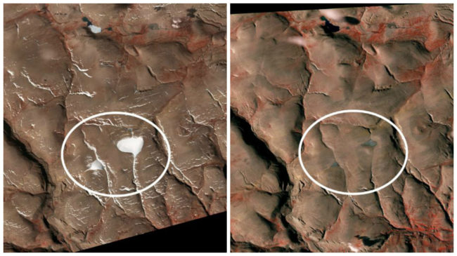
3. These ice caps on Ellesmere Island in Nunavut, Canada, have significantly shrunken between 2004 and 2015.As of 2015, the larger one was seven percent the size it was in 1959, and the smaller one was six percent of its size.
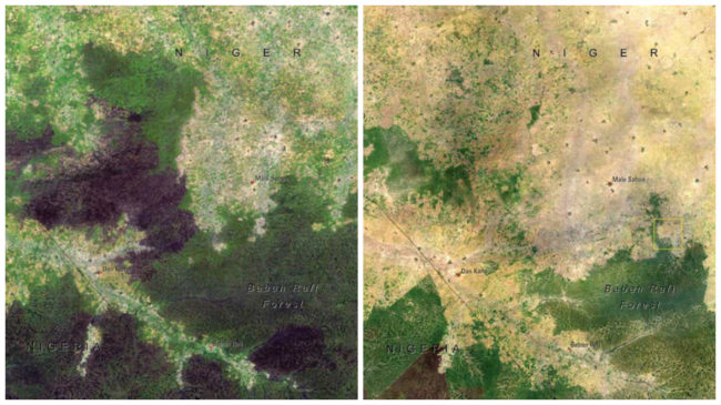
4. Population growth and a huge demand for agricultural land in the Maradi Department of Niger has caused the Baban Rafi Forest, the largest forested area, to lose a large portion of its natural landscape between 1976 and 2007.What’s left is still being exploited for products we use.
5. Despite being one of the largest reservoirs in the world, Lake Mead’s water levels have been dropping since 2000 because of long-term drought and below-average snowfall.You can see here how much it shrunk between 1982 and 2010.

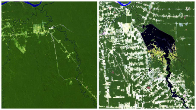
6. Between 1984 and 2011, deforestation greatly affected the area around the Jamari River in Rondonia, Brazil.The Samuel Dam, which was constructed in 1984, also created a reservoir that caused flooding and displaced many who lived there.
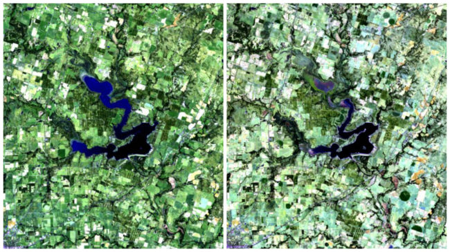
7. In Texas, crops and farmlands have been adversely affected and water levels have dropped in multiple lakes.This is because a large part of Texas is in an “exceptional” state of drought, which is the worst condition on the government’s drought monitor scale. The images below of Proctor Lake were taken just one year apart.
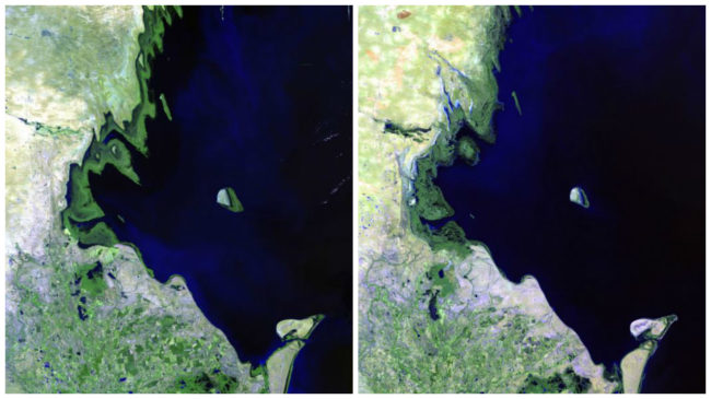
8. Heavy rainfall has increased the flow from the Volga River, which is the Caspian Sea’s main source of water.This is causing the large body of water to grow so much that it is flooding coastal settlements and even leading to the decline of wildlife on Tyuleniy Island.Below is the change between 1985 and 2011.
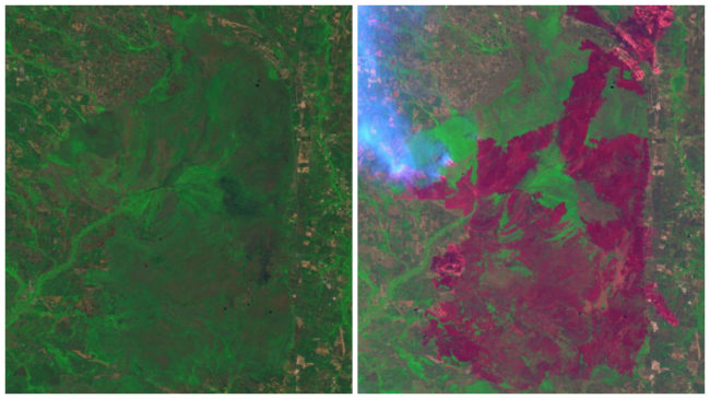
9. Dry conditions paired with lightning strikes caused wildfires to spread across the Okefenokee National Wildlife refuge in the Honey Prairie region of Georgia in April 2011.Over 290,000 acres (represented by the red shading) had burned by July, and the smoke in the right image indicated that fires were still active at that point.
10. Brush fires caused by extremely hot and dry weather conditions in Australia burned over 148,000 acres in Tasmania in January 2013.More than 40 percent of the structures in the township of Dunalley were destroyed.You can see the burned areas and smoke still rising in the right image, which was taken almost a year after the image on the left.

(via NASA)
Read More: This Man Keeps Playing The Piano As The World Literally Falls Down Around Him